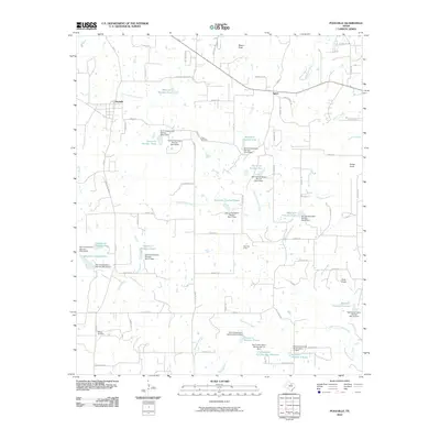
2010 Map of Poolville
USGS Topo · Published 2010About this map
The Poolville and Agnes settlements anchor this Parker County landscape, which is defined by an extensive water management network of fifteen reservoirs and numerous Soil Conservation Service dams. These structures regulate the flow of the Clear Fork Trinity River and its tributaries, such as Gourdneck Creek and Turkey Creek. The map documents a rural environment where agriculture and natural resource extraction intersect, evidenced by the presence of the Toto Gas Field.
Find a feature on this map
88 named features on this map. Tap any name to fly to it.
Don’t see what you’re looking for? This feature index may not catch every label — zoom into the map to look around manually.
Map Details
Editions of this 2010 Poolville Map
This is the sole edition of this map. No revisions or reprints were ever made.
Other maps of this area

1891 · Weatherford
USGS Topo · 1:125,000

1893 · Weatherford
USGS Topo · 1:125,000

1930 · Boyd
USGS Topo · 1:62,500

1932 · Springtown
USGS Topo · 1:62,500

1954 · Dallas
USGS Topo · 1:250,000

1954 · Sherman
USGS Topo · 1:250,000

1958 · Dallas
USGS Topo · 1:250,000

1958 · Sherman
USGS Topo · 1:250,000

1958 · Springtown
USGS Topo · 1:24,000
1959 · Lake Weatherford
USGS Topo · 1:24,000