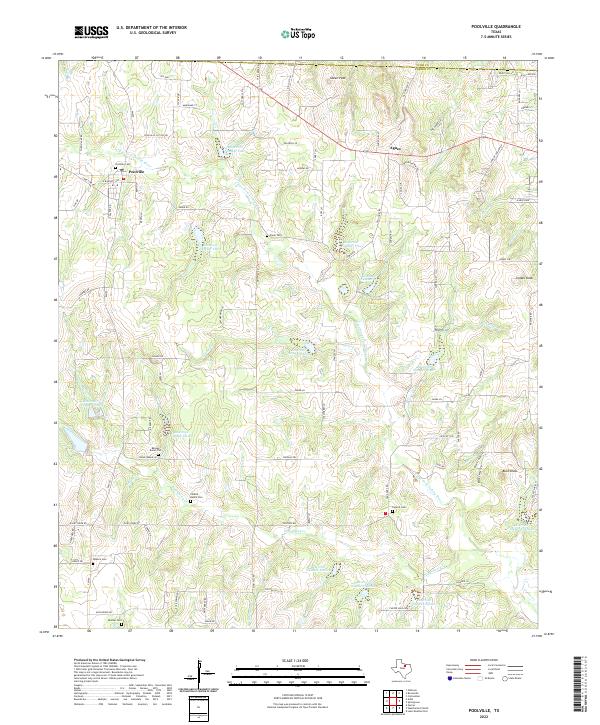
2022 Map of Poolville
USGS Topo · Published 2022About this map
The Clear Fork Trinity River winds through this section of Parker County, defining a landscape of rolling terrain and managed water resources. Small settlements like Poolville and Agnes anchor the rural community, connected by local routes like FM 920. The map is particularly dense with small-scale burial sites, offering significant value for genealogical research in this part of North Texas. Family-named locations such as the Perkins Ranch Cem, Erwin Cem, and the Reeves Burial Plot are meticulously recorded alongside larger community grounds like Poolville Cem and Central Cem.
Find a feature on this map
100 named features on this map. Tap any name to fly to it.
Don’t see what you’re looking for? This feature index may not catch every label — zoom into the map to look around manually.
Map Details
Editions of this 2022 Poolville Map
This is the sole edition of this map. No revisions or reprints were ever made.
Other maps of this area

1891 · Weatherford
USGS Topo · 1:125,000

1893 · Weatherford
USGS Topo · 1:125,000

1930 · Boyd
USGS Topo · 1:62,500

1932 · Springtown
USGS Topo · 1:62,500

1954 · Dallas
USGS Topo · 1:250,000

1954 · Sherman
USGS Topo · 1:250,000

1958 · Dallas
USGS Topo · 1:250,000

1958 · Sherman
USGS Topo · 1:250,000

1958 · Springtown
USGS Topo · 1:24,000
1959 · Lake Weatherford
USGS Topo · 1:24,000