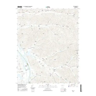
2016 Map of Pope
USGS Topo · Published 2016About this map
Kentucky Lake and the managed waters of the Gumdale Dewatering Area define the western edge of this landscape where Decatur Co and Perry Co meet. The terrain is deeply dissected by countless hollows, including Hall Deadening Hollow, Orebank Hollow, and Slickrock Hollow, creating a complex network of ridges and drainages. This 2016 survey documents the rural character of the region, anchored by small settlements like Pope and Gumdale. The map is particularly useful for genealogical research, identifying numerous family burial grounds such as Gobelet Cem, Starbuck Cem, and Bunch Cem. These sites, along with landmarks like Horses Head and Halabough Bottom, reflect a long history of local land naming and community settlement patterns along the Tennessee River valley.
Find a feature on this map
125 named features on this map. Tap any name to fly to it.
Don’t see what you’re looking for? This feature index may not catch every label — zoom into the map to look around manually.
Map Details
Editions of this 2016 Pope Map
This is the sole edition of this map. No revisions or reprints were ever made.
Other maps of this area

1905 · Waynesboro
USGS Topo · 1:125,000

1936 · Pine View
USGS Topo · 1:24,000

1936 · Bath Springs
USGS Topo · 1:24,000

1936 · Linden
USGS Topo · 1:24,000

1936 · Leatherwood
USGS Topo · 1:24,000

1936 · Clifton
USGS Topo · 1:24,000

1936 · Chestnut Grove
USGS Topo · 1:24,000

1936 · Jeannette
USGS Topo · 1:24,000

1936 · Perryville
USGS Topo · 1:24,000

1936 · Pope
USGS Topo · 1:24,000