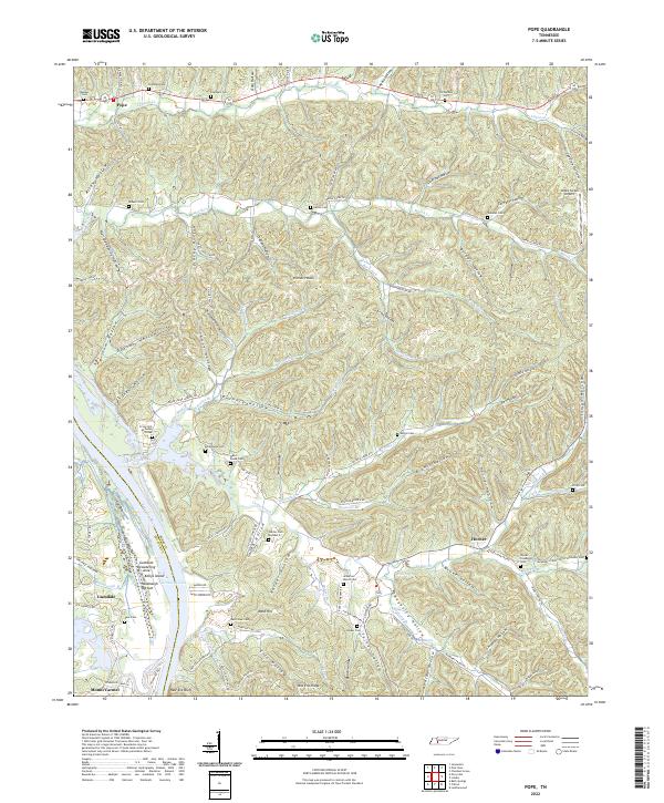
2022 Map of Pope
USGS Topo · Published 2022About this map
Kentucky Lake and the eastern banks of the Tennessee River define the western edge of this landscape, where the Decatur Co and Perry Co line follows the submerged river channel. The terrain is deeply carved by drainage systems like Cypress Cr, Marsh Cr, and Cedar Creek, which create a series of isolated ridges and named hollows such as Sutton Hollow and DePriest Hollow. These narrow valleys have historically dictated the location of homesteads and family burial grounds, evidenced by the high density of small cemeteries including Kunkel Cem, Richardson Cem, and Craig Cem At Cedar Creek.
Find a feature on this map
143 named features on this map. Tap any name to fly to it.
Don’t see what you’re looking for? This feature index may not catch every label — zoom into the map to look around manually.
Map Details
Editions of this 2022 Pope Map
This is the sole edition of this map. No revisions or reprints were ever made.
Other maps of this area

1905 · Waynesboro
USGS Topo · 1:125,000

1936 · Pine View
USGS Topo · 1:24,000

1936 · Bath Springs
USGS Topo · 1:24,000

1936 · Linden
USGS Topo · 1:24,000

1936 · Leatherwood
USGS Topo · 1:24,000

1936 · Clifton
USGS Topo · 1:24,000

1936 · Chestnut Grove
USGS Topo · 1:24,000

1936 · Jeannette
USGS Topo · 1:24,000

1936 · Perryville
USGS Topo · 1:24,000

1936 · Pope
USGS Topo · 1:24,000