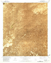
1981 Map of Pope
USGS Topo · Published 1982About this map
The Atchison Topeka and Santa Fe railroad corridor anchors this high-desert landscape in Socorro County, passing through the small settlement of Pope and the descriptively named Hard Luck Crossing. The territory is dominated by the expansive Lava fields that characterize this portion of the Jornada del Muerto, an arid stretch of New Mexico historical importance. The map clearly delineates the massive Pedro Armendaris Grant No. 33, providing a look at the historical land grant boundaries that still influence modern property lines and regional planning.
Find a feature on this map
15 named features on this map. Tap any name to fly to it.
Don’t see what you’re looking for? This feature index may not catch every label — zoom into the map to look around manually.
Map Details
Editions of this 1981 Pope Map
This is the sole edition of this map. No revisions or reprints were ever made.
Other maps of this area

1916 · Salinas Peak
USGS Topo · 1:125,000

1948 · Val Verde
USGS Topo · 1:62,500

1948 · Malpais Well
USGS Topo · 1:62,500

1954 · Tularosa
USGS Topo · 1:250,000

1958 · Tularosa
USGS Topo · 1:250,000

1961 · Paraje Well
USGS Topo · 1:24,000

1961 · Fort Craig
USGS Topo · 1:24,000

1961 · Lava
USGS Topo · 1:24,000

1979 · Truth or Consequences
USGS Topo · 1:100,000

1979 · San Mateo Mountains
USGS Topo · 1:100,000