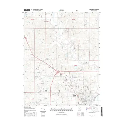
2015 Map of Poplar Bluff
USGS Topo · Published 2015About this map
The Black River serves as the central geographic anchor of this landscape, winding south from Hilliard and passing under the Mengo Bridge near Loma Linda. The city of Poplar Bluff dominates the southern portion of the sheet, showcasing its educational infrastructure through the Three Rivers Community College and the Poplar Bluff School District Practical Nurse Program. This 2015 survey illustrates a mix of suburban expansion and dense woodland, particularly where the Mark Twain National Forest borders northern settlements like Wilby. Genealogists will find a high concentration of burial sites, from the large Woodlawn Cemetery in town to smaller rural grounds like Nunley Cemetery and Three Springs Cemetery. The presence of several reservoirs, including Lake Lockoma and Chamberlain Lake, indicates a geography shaped by both natural drainage and deliberate water management for local residents in neighborhoods like Shady Dell and Green Forest.
Find a feature on this map
140 named features on this map. Tap any name to fly to it.
Don’t see what you’re looking for? This feature index may not catch every label — zoom into the map to look around manually.
Map Details
Editions of this 2015 Poplar Bluff Map
This is the sole edition of this map. No revisions or reprints were ever made.
Other maps of this area

1934 · Williamsville
USGS Topo · 1:48,000

1935 · Poplar Bluff
USGS Topo · 1:62,500

1935 · Acorn
USGS Topo · 1:62,500

1935 · Harviell
USGS Topo · 1:62,500

1939 · Poplar Bluff
USGS Topo · 1:62,500

1940 · Williamsville
USGS Topo · 1:62,500

1940 · Naylor
USGS Topo · 1:62,500

1944 · Naylor
USGS Topo · 1:62,500

1949 · Poplar Bluff
USGS Topo · 1:62,500

1957 · Poplar Bluff
USGS Topo · 1:250,000