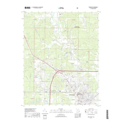
2017 Map of Poplar Bluff
USGS Topo · Published 2017About this map
The Black River winds southward through this part of Butler County, anchoring a landscape where the northern reaches of Poplar Bluff meet the dense woodlands of the Mark Twain National Forest. The transition from urban center to rural timberland is marked by a series of distinct residential and small-community clusters, including Loma Linda, Cedar Valley, and Shady Dell. Education and local heritage are prominent, evidenced by the campus of Three Rivers Community College and a high density of historic family and community burial grounds such as Oak Hill Cemetery and Woodlawn Cemetery. To the north, the river creates significant bends and backwaters near Hilliard and Wilby, while man-made landmarks like Lake Lockloma and Hon-Dah Reservoir highlight the region's managed water resources. This survey illustrates the intricate network of county roads and residential developments that define the periphery of this regional hub.
Find a feature on this map
210 named features on this map. Tap any name to fly to it.
Don’t see what you’re looking for? This feature index may not catch every label — zoom into the map to look around manually.
Map Details
Editions of this 2017 Poplar Bluff Map
This is the sole edition of this map. No revisions or reprints were ever made.
Other maps of this area

1934 · Williamsville
USGS Topo · 1:48,000

1935 · Poplar Bluff
USGS Topo · 1:62,500

1935 · Acorn
USGS Topo · 1:62,500

1935 · Harviell
USGS Topo · 1:62,500

1939 · Poplar Bluff
USGS Topo · 1:62,500

1940 · Williamsville
USGS Topo · 1:62,500

1940 · Naylor
USGS Topo · 1:62,500

1944 · Naylor
USGS Topo · 1:62,500

1949 · Poplar Bluff
USGS Topo · 1:62,500

1957 · Poplar Bluff
USGS Topo · 1:250,000