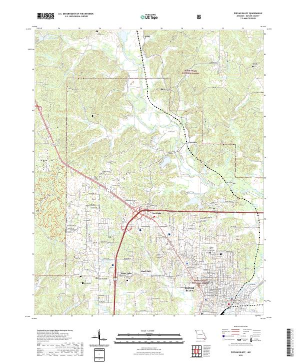
2021 Map of Poplar Bluff
USGS Topo · Published 2021About this map
Poplar Bluff anchors this Butler County landscape where the Black River emerges from the hills of the Mark Twain National Forest. The city’s civic and educational heart is well-defined, featuring the Butler County Courthouse and the campus of Three Rivers College. The map reveals a high density of neighborhood history through its burial grounds, including the Woodlawn Cem, Poplar Bluff City Cem, and the Sacred Heart Catholic Cem to the south. Outlying areas like Loma Linda, Shady Dell, and Green Forest show the pattern of residential growth along the Union Pacific rail corridor. Water features such as Lake Lackawanna, Shore Acres Lake, and Mengo Slough characterize the transition from the upland forest toward the river lowlands, reflecting the regional geography of the Ozark Foothills.
Find a feature on this map
195 named features on this map. Tap any name to fly to it.
Don’t see what you’re looking for? This feature index may not catch every label — zoom into the map to look around manually.
Map Details
Editions of this 2021 Poplar Bluff Map
This is the sole edition of this map. No revisions or reprints were ever made.
Other maps of this area

1934 · Williamsville
USGS Topo · 1:48,000

1935 · Poplar Bluff
USGS Topo · 1:62,500

1935 · Acorn
USGS Topo · 1:62,500

1935 · Harviell
USGS Topo · 1:62,500

1939 · Poplar Bluff
USGS Topo · 1:62,500

1940 · Williamsville
USGS Topo · 1:62,500

1940 · Naylor
USGS Topo · 1:62,500

1944 · Naylor
USGS Topo · 1:62,500

1949 · Poplar Bluff
USGS Topo · 1:62,500

1957 · Poplar Bluff
USGS Topo · 1:250,000