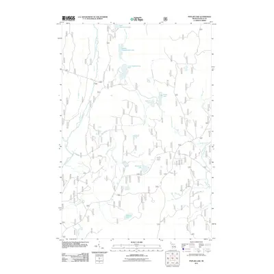
2011 Map of Poplar Lake
USGS Topo · Published 2011About this map
Haymeadow Falls and a dense network of glacial lakes define this interior portion of the Hiawatha National Forest in the early 21st century. The landscape is characterized by a chain of water bodies including Upper Eighteenmile Lake, Middle Eighteenmile Lake, and Lower Eighteenmile Lake, which feed the hydrological system of the central Upper Peninsula. The drainage patterns are clear as the East Branch Whitefish River and Haymeadow Creek wind through the timberlands, punctuated by smaller basins like Peacock Lake and Greens Lake. Settlement is sparse, represented primarily by a grid of forest service routes such as Forest Rd 2230 and the Rapid River Truck Trl, reflecting the area's primary use for timber management and backcountry recreation. This survey captures the region before major modern shifts in forest service road designations, preserving the specific navigational nomenclature used by local residents and outdoorsmen.
Find a feature on this map
26 named features on this map. Tap any name to fly to it.
Don’t see what you’re looking for? This feature index may not catch every label — zoom into the map to look around manually.
Map Details
Editions of this 2011 Poplar Lake Map
This is the sole edition of this map. No revisions or reprints were ever made.
Other maps of this area

1932 · Rapid River NE
USGS Topo · 1:31,680

1932 · Trenary SW
USGS Topo · 1:31,680

1932 · Garden NW and SW
USGS Topo · 1:31,680

1932 · Rapid River NW
USGS Topo · 1:31,680

1932 · Trenary SE
USGS Topo · 1:31,680

1932 · Skeels Lake NW and SW
USGS Topo · 1:31,680

1954 · Escanaba
USGS Topo · 1:250,000

1957 · Escanaba
USGS Topo · 1:250,000

1958 · Escanaba
USGS Topo · 1:250,000

1958 · Corner Lake
USGS Topo · 1:62,500