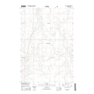
2014 Map of Poplar Lake
USGS Topo · Published 2014About this map
Hiawatha National Forest dominates this section of Michigan's Upper Peninsula, revealing a complex glaciated landscape defined by its intricate water systems. The map traces the north-south progression of the Eighteenmile Lake chain, from Upper Eighteenmile Lake through Middle Eighteenmile Lake to Lower Eighteenmile Lake. This hydrology is further defined by the East Branch Whitefish River and the meandering course of Haymeadow Creek, which features the notable Haymeadow Falls. These waterways emphasize the remote, undeveloped character of Delta County during this period. The eastern portion of the quadrangle is marked by the presence of the Sturgeon River and smaller isolated basins like Poplar Lake and Peacock Lake. The drainage patterns and topographic contours shown here reflect the classic timber and wetland environments that characterize the region's wilderness heritage.
Find a feature on this map
21 named features on this map. Tap any name to fly to it.
Don’t see what you’re looking for? This feature index may not catch every label — zoom into the map to look around manually.
Map Details
Editions of this 2014 Poplar Lake Map
This is the sole edition of this map. No revisions or reprints were ever made.
Other maps of this area

1932 · Rapid River NE
USGS Topo · 1:31,680

1932 · Trenary SW
USGS Topo · 1:31,680

1932 · Garden NW and SW
USGS Topo · 1:31,680

1932 · Rapid River NW
USGS Topo · 1:31,680

1932 · Trenary SE
USGS Topo · 1:31,680

1932 · Skeels Lake NW and SW
USGS Topo · 1:31,680

1954 · Escanaba
USGS Topo · 1:250,000

1957 · Escanaba
USGS Topo · 1:250,000

1958 · Escanaba
USGS Topo · 1:250,000

1958 · Corner Lake
USGS Topo · 1:62,500