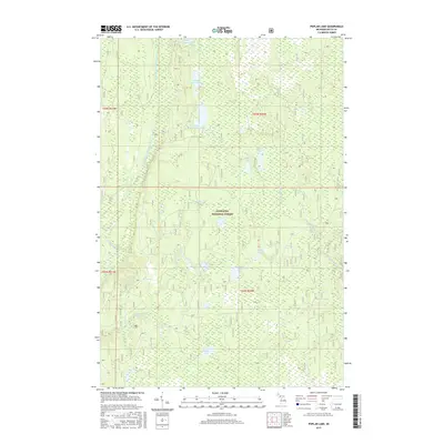
2017 Map of Poplar Lake
USGS Topo · Published 2017About this map
Hiawatha National Forest dominates this section of the Upper Peninsula, where a dense network of water bodies defines the wilderness character of Delta County. The northern portion is distinguished by a chain of glacial lakes, including Upper Eighteenmile Lake, Middle Eighteenmile Lake, and Lower Eighteenmile Lake. This hydrological system feeds into the Haymeadow Creek drainage, which features the notable Haymeadow Falls in the southwestern quadrant.
Find a feature on this map
21 named features on this map. Tap any name to fly to it.
Don’t see what you’re looking for? This feature index may not catch every label — zoom into the map to look around manually.
Map Details
Editions of this 2017 Poplar Lake Map
This is the sole edition of this map. No revisions or reprints were ever made.
Other maps of this area

1932 · Rapid River NE
USGS Topo · 1:31,680

1932 · Trenary SW
USGS Topo · 1:31,680

1932 · Garden NW and SW
USGS Topo · 1:31,680

1932 · Rapid River NW
USGS Topo · 1:31,680

1932 · Trenary SE
USGS Topo · 1:31,680

1932 · Skeels Lake NW and SW
USGS Topo · 1:31,680

1954 · Escanaba
USGS Topo · 1:250,000

1957 · Escanaba
USGS Topo · 1:250,000

1958 · Escanaba
USGS Topo · 1:250,000

1958 · Corner Lake
USGS Topo · 1:62,500