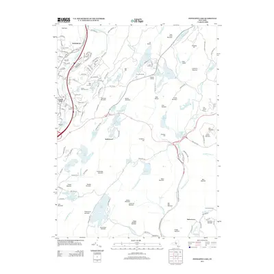
2013 Map of Popolopen Lake
USGS Topo · Published 2013About this map
Harriman State Park dominates this terrain, revealing a landscape defined by its network of high-elevation lakes and recreation areas. In the northwestern corner, the settlement of Woodbury and the community of Central Valley sit near Cem of the Highlands, while further south the map captures smaller pockets like Baileytown and Bulsontown. Significant institutional and military footprints are visible, including the W Point Military Resv and training grounds such as Camp Buckner and Camp Natural Bridge. The area's focus on outdoor life is evident in the numerous camps and the Central Valley Golf Course. High points like Bear Mountain and the Perkins Memorial Observatory anchor the eastern edge, overlooking the waters of Popolopen Lake and the storied Silver Mine Lake.
Find a feature on this map
169 named features on this map. Tap any name to fly to it.
Don’t see what you’re looking for? This feature index may not catch every label — zoom into the map to look around manually.
Map Details
Editions of this 2013 Popolopen Lake Map
This is the sole edition of this map. No revisions or reprints were ever made.
Other maps of this area

1891 · Ramapo
USGS Topo · 1:62,500

1892 · West Point
USGS Topo · 1:62,500

1892 · Tarrytown
USGS Topo · 1:62,500

1893 · Tarrytown
USGS Topo · 1:62,500

1893 · Ramapo
USGS Topo · 1:62,500

1894 · West Point
USGS Topo · 1:62,500

1899 · West Point
USGS Topo · 1:62,500

1901 · West Point
USGS Topo · 1:62,500

1902 · Tarrytown
USGS Topo · 1:62,500

1902 · Schunemunk
USGS Topo · 1:62,500