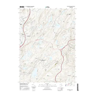
2016 Map of Popolopen Lake
USGS Topo · Published 2016About this map
Highland Mills and Central Valley anchor the western edge of this Hudson Highlands landscape, where the residential corridors of Woodbury meet the sprawling protected lands of Harriman State Park. The terrain is defined by a dense network of high ridges and glacial lakes, including Popolopen Lake, Stillwell Lake, and Summit Lake. This area serves as a critical junction for historical transit, as the Appalachian National Scenic Trail winds over peaks like Stockbridge Mtn and Black Mtn. Local history is preserved at the Cem of the Highlands and Galloways Cem, while the eastern reaches extend toward the military reservation of West Point and the historic settlement of Fort Montgomery. The map reveals how 20th-century road developments like Seven Lakes Dr were carved through a landscape of formidable peaks such as Bear Mtn and The Torne.
Find a feature on this map
146 named features on this map. Tap any name to fly to it.
Don’t see what you’re looking for? This feature index may not catch every label — zoom into the map to look around manually.
Map Details
Editions of this 2016 Popolopen Lake Map
This is the sole edition of this map. No revisions or reprints were ever made.
Other maps of this area

1891 · Ramapo
USGS Topo · 1:62,500

1892 · West Point
USGS Topo · 1:62,500

1892 · Tarrytown
USGS Topo · 1:62,500

1893 · Tarrytown
USGS Topo · 1:62,500

1893 · Ramapo
USGS Topo · 1:62,500

1894 · West Point
USGS Topo · 1:62,500

1899 · West Point
USGS Topo · 1:62,500

1901 · West Point
USGS Topo · 1:62,500

1902 · Tarrytown
USGS Topo · 1:62,500

1902 · Schunemunk
USGS Topo · 1:62,500