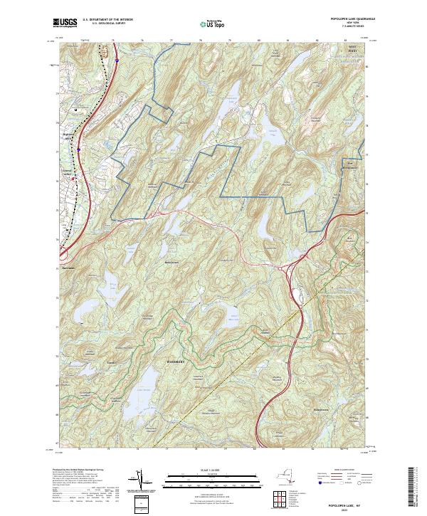
2023 Map of Popolopen Lake
USGS Topo · Published 2023About this map
The West Point Military Reservation and the sprawling expanse of Harriman State Park dominate this section of Orange County, where the Hudson Highlands provide a complex landscape of summits and secluded water bodies. Small settlements like Highland Mills and Central Valley line the western corridor, while interior hamlets such as Baileytown and Bulsontown reflect the region's long-standing residential character. The terrain is defined by dramatic elevations, including Bear Mountain and the steep slopes of The Torne near Fort Montgomery.
Find a feature on this map
143 named features on this map. Tap any name to fly to it.
Don’t see what you’re looking for? This feature index may not catch every label — zoom into the map to look around manually.
Map Details
Editions of this 2023 Popolopen Lake Map
This is the sole edition of this map. No revisions or reprints were ever made.
Other maps of this area

1891 · Ramapo
USGS Topo · 1:62,500

1892 · West Point
USGS Topo · 1:62,500

1892 · Tarrytown
USGS Topo · 1:62,500

1893 · Tarrytown
USGS Topo · 1:62,500

1893 · Ramapo
USGS Topo · 1:62,500

1894 · West Point
USGS Topo · 1:62,500

1899 · West Point
USGS Topo · 1:62,500

1901 · West Point
USGS Topo · 1:62,500

1902 · Tarrytown
USGS Topo · 1:62,500

1902 · Schunemunk
USGS Topo · 1:62,500