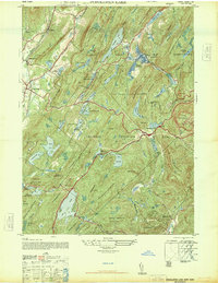
1946 Map of Popolopen Lake
USGS Topo · Published 1947About this map
West Point Military Reservation dominates the northern landscape of this post-war survey, centered on the strategic and recreational waters of Popolopen Lake. The map illustrates a region defined by its rugged topography and industrial history, most notably marked by the Forrest of Dean Mine near Mine Lake. While the northwestern corner shows the growing residential centers of Highland Mills and Central Valley, much of the terrain is dedicated to the preserved wilderness of Palisades Interstate Park. The dense concentration of water bodies, including Lake Tiorati, Lake Menomini, and Upper Twin Lake, highlights the complex watershed that has long served both military training needs at Camp Buckner and public recreation. Small, localized settlements such as Baileytown and Butsontown provide evidence of rural life tucked between significant peaks like Bear Mountain and Stockbridge Mountain.
Find a feature on this map
62 named features on this map. Tap any name to fly to it.
Don’t see what you’re looking for? This feature index may not catch every label — zoom into the map to look around manually.
Map Details
Editions of this 1946 Popolopen Lake Map
This is the sole edition of this map. No revisions or reprints were ever made.
Other maps of this area

1891 · Ramapo
USGS Topo · 1:62,500

1892 · West Point
USGS Topo · 1:62,500

1892 · Tarrytown
USGS Topo · 1:62,500

1893 · Tarrytown
USGS Topo · 1:62,500

1893 · Ramapo
USGS Topo · 1:62,500

1894 · West Point
USGS Topo · 1:62,500

1899 · West Point
USGS Topo · 1:62,500

1901 · West Point
USGS Topo · 1:62,500

1902 · Tarrytown
USGS Topo · 1:62,500

1902 · Schunemunk
USGS Topo · 1:62,500