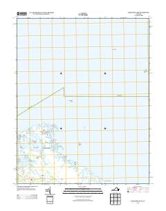
2013 Map of Poquoson East
USGS Topo · Published 2013About this map
Odd stands as a primary inland anchor on this 2013 survey of the Virginia coast where the Lower Peninsula meets the Chesapeake Bay. The landscape is a complex amphibious network of marshlands and tidal guts, featuring significant coastal landmarks like Blackwalnut Ridge and the York Spit Lighthouse. Navigational hazards and local geography are defined by extensive shallows such as Poquoson Flats and Drum Island Flats, which protect the inner reaches of Lloyd Bay and Easton Cove. This mapping captures the intricate shoreline just before the impacts of modern sea-level rise and coastal erosion further altered the profile of islands like Blacksnake Island, Sheep Island, and Whalebone Island. The intricate transition from the mainland out to Plumtree Point illustrates the unique maritime character of the Hampton Roads region, preserved here in high-resolution detail.
Find a feature on this map
31 named features on this map. Tap any name to fly to it.
Don’t see what you’re looking for? This feature index may not catch every label — zoom into the map to look around manually.
Map Details
Editions of this 2013 Poquoson East Map
This is the sole edition of this map. No revisions or reprints were ever made.
Other maps of this area

1907 · Hampton
USGS Topo · 1:62,500

1916 · Mathews
USGS Topo · 1:62,500

1917 · Mathews
USGS Topo · 1:62,500

1943 · Richmond
USGS Topo · 1:250,000

1944 · Hampton
USGS Topo · 1:24,000

1944 · Messick
USGS Topo · 1:24,000

1944 · Morrison
USGS Topo · 1:24,000

1944 · Harris Grove
USGS Topo · 1:24,000

1948 · Achilles
USGS Topo · 1:24,000

1948 · New Point Comfort
USGS Topo · 1:24,000