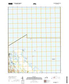
2019 Map of Poquoson East
USGS Topo · Published 2019About this map
Poquoson and its intricate coastal marshlands are the focus of this 2019 survey, illustrating the complex intersection of land and water along the western shore of the Chesapeake. The geography is defined by a dense network of tidal guts and estuaries, including Bennett Creek, Gum Hammock Creek, and Fire Pine Cr, which carve through the Big Salt Marsh. Named landforms like Blackwalnut Ridge and Plumtree Point represent the stable ground amidst a shifting landscape of islands and flats such as Whalebone Island and the Poquoson Flats.
Find a feature on this map
32 named features on this map. Tap any name to fly to it.
Don’t see what you’re looking for? This feature index may not catch every label — zoom into the map to look around manually.
Map Details
Editions of this 2019 Poquoson East Map
This is the sole edition of this map. No revisions or reprints were ever made.
Other maps of this area

1907 · Hampton
USGS Topo · 1:62,500

1916 · Mathews
USGS Topo · 1:62,500

1917 · Mathews
USGS Topo · 1:62,500

1943 · Richmond
USGS Topo · 1:250,000

1944 · Hampton
USGS Topo · 1:24,000

1944 · Messick
USGS Topo · 1:24,000

1944 · Morrison
USGS Topo · 1:24,000

1944 · Harris Grove
USGS Topo · 1:24,000

1948 · Achilles
USGS Topo · 1:24,000

1948 · New Point Comfort
USGS Topo · 1:24,000