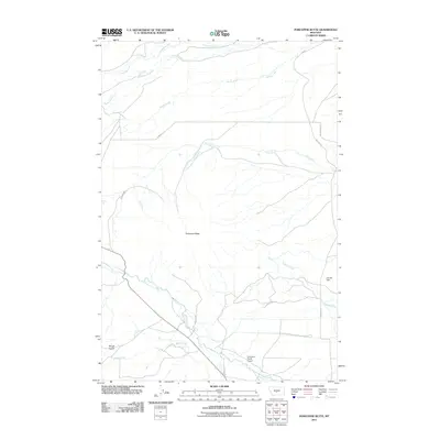
2011 Map of Porcupine Butte
USGS Topo · Published 2011About this map
Porcupine Butte commands this section of Wheatland County, serving as a high-elevation anchor for a complex network of waterways and ranch-road infrastructure. The map details an environment defined by its water management and aviation access, featuring the Cottontail Ranch Airport and the Donald Dam. These elements reflect a landscape adapted for large-scale ranching and private transit in a region where surface water is carefully channeled through features like the Tronrud Ditch. A series of streams, including Sweet Grass Creek, Fish Creek, and the American Fork, drain the surrounding slopes, while named thoroughfares such as Melville Rd and Bill Donald Rd provide the primary connections through the foothills. The presence of Rough Gulch and Basin Creek further illustrates the varied drainage patterns that shape this corner of Montana.
Find a feature on this map
17 named features on this map. Tap any name to fly to it.
Don’t see what you’re looking for? This feature index may not catch every label — zoom into the map to look around manually.
Map Details
Editions of this 2011 Porcupine Butte Map
This is the sole edition of this map. No revisions or reprints were ever made.
Other maps of this area

1886 · Little Belt Mts.
USGS Topo · 1:250,000

1889 · Big Snowy Mountain
USGS Topo · 1:250,000

1893 · Big Snowy Mountain
USGS Topo · 1:250,000

1894 · Little Belt Mts.
USGS Topo · 1:250,000

1897 · Little Belt Mts.
USGS Topo · 1:250,000

1898 · Little Belt Mts.
USGS Topo · 1:250,000

1902 · Little Belt Mts.
USGS Topo · 1:250,000

1948 · White Sulphur Springs
USGS Topo · 1:250,000

1954 · Roundup
USGS Topo · 1:250,000

1958 · Roundup
USGS Topo · 1:250,000