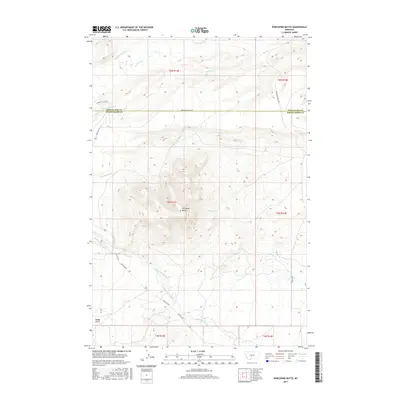
2017 Map of Porcupine Butte
USGS Topo · Published 2017About this map
Porcupine Butte commands the center of this landscape on the border of Wheatland and Sweet Grass counties. This high-plains terrain is defined by a complex network of water rights and irrigation engineering, evidenced by the American Fork Ranch Ditch and Tronrud Ditch. These man-made channels divert water from natural flows like American Fork and Lebo Cr to support the local ranching economy. The map reveals how historical land use follows the drainage patterns of Sweet Grass Creek and its many tributaries, such as Agnes Cr and Cayuse Cr. Transportation across this rangeland relies on established routes like Melville Rd and State Hwy 371, which skirt the base of the butte and navigate the draws of Rough Gulch.
Find a feature on this map
25 named features on this map. Tap any name to fly to it.
Don’t see what you’re looking for? This feature index may not catch every label — zoom into the map to look around manually.
Map Details
Editions of this 2017 Porcupine Butte Map
This is the sole edition of this map. No revisions or reprints were ever made.
Other maps of this area

1886 · Little Belt Mts.
USGS Topo · 1:250,000

1889 · Big Snowy Mountain
USGS Topo · 1:250,000

1893 · Big Snowy Mountain
USGS Topo · 1:250,000

1894 · Little Belt Mts.
USGS Topo · 1:250,000

1897 · Little Belt Mts.
USGS Topo · 1:250,000

1898 · Little Belt Mts.
USGS Topo · 1:250,000

1902 · Little Belt Mts.
USGS Topo · 1:250,000

1948 · White Sulphur Springs
USGS Topo · 1:250,000

1954 · Roundup
USGS Topo · 1:250,000

1958 · Roundup
USGS Topo · 1:250,000