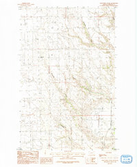
1984 Map of Porcupine Coulee
USGS Topo · Published 1984About this map
Porcupine Coulee and its neighboring drainages define the character of this Phillips County landscape during the mid-1970s and early 1980s. The terrain is marked by a network of seasonal watercourses including Rattlesnake Coulee, Poplar Coulee, and Prestige Coulee, which cut through the high plains. Human presence is sparse and functional, centered on water sources and basic transport. Notable landmarks such as Split Shack Spring indicate the critical importance of water for ranching or travel in this arid region, while a remote Airstrip in the southeast corner suggests the vast distances required for aerial access in rural Montana. The map illustrates a network of unimproved roads and trails that navigate the elevation changes between the coulee floors and the surrounding plateaus, providing a clear record of the area's pastoral infrastructure before the turn of the century.
Find a feature on this map
9 named features on this map. Tap any name to fly to it.
Don’t see what you’re looking for? This feature index may not catch every label — zoom into the map to look around manually.
Map Details
Editions of this 1984 Porcupine Coulee Map
This is the sole edition of this map. No revisions or reprints were ever made.
Other maps of this area

1954 · Glasgow
USGS Topo · 1:250,000

1957 · Glasgow
USGS Topo · 1:250,000

1958 · Glasgow
USGS Topo · 1:250,000

1984 · Cole
USGS Topo · 1:24,000

1984 · Bjornberg Bridge
USGS Topo · 1:24,000

1984 · Double S Hill
USGS Topo · 1:24,000

1984 · Forks
USGS Topo · 1:24,000

1984 · Coulter Coulee
USGS Topo · 1:24,000

1984 · Dead Horse Coulee
USGS Topo · 1:24,000
1984 · Salsbery Reservoir
USGS Topo · 1:24,000