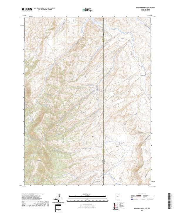
2023 Map of Porcupine Ridge
USGS Topo · Published 2023About this map
Porcupine Ridge and Porcupine Mtn dominate the western terrain of this high-elevation landscape along the border of Utah and Wyoming. This survey documents a complex network of seasonal drainages and local roads that define the rural ranching and resource territory within Summit County, Utah, and Uinta County, Wyoming. The presence of the Barker Reservoir near the northern boundary and the expansive Chalk Creek Basin to the southeast indicates the importance of water management in this arid environment. Local transit is facilitated by unpaved corridors such as Chalk Creek Rd and Yellow Creek Rd, which follow the natural contours of the land. The map also traces various natural draws, including Sage Creek Draw and Randall Draw, providing a precise look at the hydrography that feeds into larger systems like Chalk Creek.
Find a feature on this map
26 named features on this map. Tap any name to fly to it.
Don’t see what you’re looking for? This feature index may not catch every label — zoom into the map to look around manually.
Map Details
Editions of this 2023 Porcupine Ridge Map
This is the sole edition of this map. No revisions or reprints were ever made.
Other maps of this area

1885 · Salt Lake
USGS Topo · 1:250,000

1885 · Uinta
USGS Topo · 1:250,000

1900 · Coalville
USGS Topo · 1:125,000

1901 · Hayden Peak
USGS Topo · 1:125,000

1903 · Hayden Peak
USGS Topo · 1:125,000

1903 · Coalville
USGS Topo · 1:125,000

1954 · Salt Lake City
USGS Topo · 1:250,000

1954 · Ogden
USGS Topo · 1:250,000

1958 · Ogden
USGS Topo · 1:250,000

1958 · Salt Lake City
USGS Topo · 1:250,000