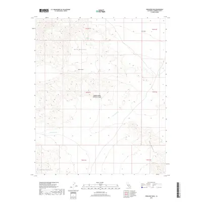
2018 Map of Porcupine Wash
USGS Topo · Published 2018About this map
Joshua Tree National Park encompasses the heart of this landscape, where the high and low deserts meet amidst a series of prominent mountain ranges. The northern portion of the map is dominated by the Hexie Mountains, which slope down into the broad, arid expanse of the Pinto Basin. This area reflects the characteristic topography of the eastern Mojave Desert, defined by massive drainage systems like the Smoke Tree Wash that carry water from the heights during rare rain events.
Find a feature on this map
14 named features on this map. Tap any name to fly to it.
Don’t see what you’re looking for? This feature index may not catch every label — zoom into the map to look around manually.
Map Details
Editions of this 2018 Porcupine Wash Map
This is the sole edition of this map. No revisions or reprints were ever made.
Other maps of this area

1940 · Cottonwood Spring
USGS Topo · 1:62,500

1940 · Canyon Spring
USGS Topo · 1:62,500

1943 · Canyon Spring
USGS Topo · 1:62,500

1943 · Pinkham Well
USGS Topo · 1:62,500

1944 · Cottonwood Spring
USGS Topo · 1:62,500

1944 · Pinkham Well
USGS Topo · 1:62,500

1944 · Eagle Tank
USGS Topo · 1:62,500

1954 · Salton Sea
USGS Topo · 1:250,000

1955 · Salton Sea
USGS Topo · 1:250,000
1958 · Cottonwood Spring
USGS Topo · 1:62,500