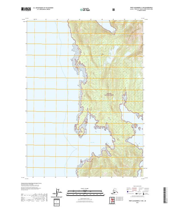
2021 Map of Port Alexander A-1 NW
USGS Topo · Published 2021About this map
Tongass National Forest dominates this coastal landscape on the Port Alexander A-1 NW quadrangle, showcasing the complex, rugged shoreline of Southeast Alaska. The terrain is defined by steep forested ridges and intricate inlets, with Table Bay carving deep into the landmass. This 2021 study reveals a wilderness nearly devoid of modern development, where the map labels only the federal forest lands and the shorthand TNF markers. The intricate contour lines illustrate the sharp elevation changes from sea level to high alpine peaks, providing a clear picture of the natural drainages and tidal zones within this protected maritime ecosystem.
Find a feature on this map
7 named features on this map. Tap any name to fly to it.
Don’t see what you’re looking for? This feature index may not catch every label — zoom into the map to look around manually.
Map Details
Editions of this 2021 Port Alexander A-1 NW Map
This is the sole edition of this map. No revisions or reprints were ever made.
Other maps of this area

1948 · Port Alexander A-1
USGS Topo · 1:63,360

1948 · Port Alexander B-1
USGS Topo · 1:63,360

1948 · Port Alexander A-2
USGS Topo · 1:63,360

1948 · Port Alexander B-2
USGS Topo · 1:63,360

1951 · Port Alexander
USGS Topo · 1:250,000

1951 · Port Alexander B-2
USGS Topo · 1:63,360
1951 · Port Alexander A-2
USGS Topo · 1:63,360

1952 · Port Alexander
USGS Topo · 1:250,000
1953 · Port Alexander B-1
USGS Topo · 1:63,360

1964 · Port Alexander
USGS Topo · 1:250,000