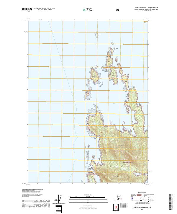
2021 Map of Port Alexander B-1 NW
USGS Topo · Published 2021About this map
Tongass National Forest encompasses the rugged island terrain of this coastal Alaskan landscape, where the sea meets heavily timbered mountains. The interior is dominated by the prominent peaks of North Mtn and White Mtn, providing a dramatic backdrop to the intricate network of waterways. Navigational landmarks define the maritime character of the region, from the sheltered waters of Explorer Basin and Tebenkof Bay to the open expanse of Chatham Strait. The archipelago nature of the coast is evident in the cluster of the Troller Islands and Windfall Islands, separated by the Heliantus Passage. These landforms, including Swaine Point and Troller Point, highlight the complex shoreline of Kuiu Island as it was charted in the early 21st century.
Find a feature on this map
17 named features on this map. Tap any name to fly to it.
Don’t see what you’re looking for? This feature index may not catch every label — zoom into the map to look around manually.
Map Details
Editions of this 2021 Port Alexander B-1 NW Map
This is the sole edition of this map. No revisions or reprints were ever made.
Other maps of this area

1948 · Port Alexander C-1
USGS Topo · 1:63,360

1948 · Port Alexander B-1
USGS Topo · 1:63,360

1948 · Port Alexander B-2
USGS Topo · 1:63,360

1951 · Port Alexander C-2
USGS Topo · 1:63,360

1951 · Port Alexander
USGS Topo · 1:250,000

1951 · Port Alexander B-2
USGS Topo · 1:63,360

1951 · Port Alexander C-1
USGS Topo · 1:63,360

1952 · Port Alexander
USGS Topo · 1:250,000
1953 · Port Alexander B-1
USGS Topo · 1:63,360

1964 · Port Alexander
USGS Topo · 1:250,000