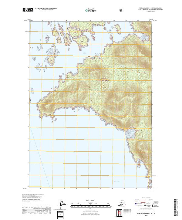
2021 Map of Port Alexander C-1 SW
USGS Topo · Published 2021About this map
Tongass National Forest dominates this coastal Alaska landscape, characterized by an intricate network of islands and deep inlets. The western reaches of the quadrangle are defined by Point Ellis, a prominent headland jutting into the Pacific waters. To the north, the Bay of Pillars is dotted with numerous small islands and islets, illustrating the fractured geography of the Alexander Archipelago. Inland, the terrain rises sharply from the shoreline, drained by coastal waterways such as Kwatahein Cr. The southern portion of the map opens into the wide expanse of Tebenkof Bay, where the dense timber of the national forest meets the tidal flats. This area represents a wilderness environment where the lack of roads or established settlements underscores the reliance on maritime and natural waterways for navigation and resource access.
Find a feature on this map
12 named features on this map. Tap any name to fly to it.
Don’t see what you’re looking for? This feature index may not catch every label — zoom into the map to look around manually.
Map Details
Editions of this 2021 Port Alexander C-1 SW Map
This is the sole edition of this map. No revisions or reprints were ever made.
Other maps of this area

1948 · Port Alexander C-1
USGS Topo · 1:63,360

1948 · Port Alexander B-1
USGS Topo · 1:63,360

1948 · Port Alexander B-2
USGS Topo · 1:63,360

1951 · Port Alexander C-2
USGS Topo · 1:63,360

1951 · Port Alexander
USGS Topo · 1:250,000

1951 · Port Alexander B-2
USGS Topo · 1:63,360

1951 · Port Alexander C-1
USGS Topo · 1:63,360

1952 · Port Alexander
USGS Topo · 1:250,000
1953 · Port Alexander B-1
USGS Topo · 1:63,360

1964 · Port Alexander
USGS Topo · 1:250,000