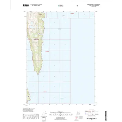
2017 Map of Port Alexander C-2 SW
USGS Topo · Published 2017About this map
Tongass National Forest dominates this coastal landscape in Southeast Alaska, where a narrow, mountainous peninsula extends into the Gulf of Alaska. The terrain is characterized by steep elevation changes and intricate shorelines, most notably along the western edge where Patterson Bay carves deeply into the landmass. This 2017 survey illustrates the intersection of maritime navigation and protected federal lands, marking the rugged southern tip of the peninsula at Patterson Point. To the east, the map opens into the vast expanse of the Gulf of Alaska, while the northern portion touches the waters of Chatham Strait. Smaller coastal features like Lords Pocket suggest the type of sheltered coves essential for seafaring in the Alexander Archipelago. The absence of roads or developed settlements highlights the wild, undeveloped nature of this portion of the Sitka borough.
Find a feature on this map
11 named features on this map. Tap any name to fly to it.
Don’t see what you’re looking for? This feature index may not catch every label — zoom into the map to look around manually.
Map Details
Editions of this 2017 Port Alexander C-2 SW Map
This is the sole edition of this map. No revisions or reprints were ever made.
Other maps of this area

1948 · Port Alexander B-2
USGS Topo · 1:63,360

1951 · Port Alexander C-2
USGS Topo · 1:63,360

1951 · Port Alexander B-3 and B-4
USGS Topo · 1:63,360

1951 · Port Alexander C-3
USGS Topo · 1:63,360

1951 · Port Alexander
USGS Topo · 1:250,000

1951 · Port Alexander B-2
USGS Topo · 1:63,360

1952 · Port Alexander
USGS Topo · 1:250,000

1964 · Port Alexander
USGS Topo · 1:250,000

1994 · Port Alexander C-3
USGS Topo · 1:63,360
2017 · Port Alexander C-3 NE
USGS Topo · 1:25,000