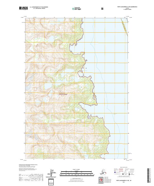
2021 Map of Port Alexander D-3 NE
USGS Topo · Published 2021About this map
Tongass National Forest dominates this coastal stretch of Baranof Island, where the steep terrain of the Alexander Archipelago meets the open waters of the Chatham Strait. The landscape is defined by dramatic elevation gains, rising from the inlets of Nelson Bay to high peaks such as Mt Radamaker and Mt Race. These summits overlook a complex network of alpine and coastal water bodies, including the remote Four Falls Lake and the Wakefield Lakes near the southern boundary. The map captures the meeting point of the Sitka City and Borough and the Hoonah-Angoon Census Area, illustrating how political boundaries in Southeast Alaska often follow the high ridges and wild coastlines of the temperate rainforest.
Find a feature on this map
14 named features on this map. Tap any name to fly to it.
Don’t see what you’re looking for? This feature index may not catch every label — zoom into the map to look around manually.
Map Details
Editions of this 2021 Port Alexander D-3 NE Map
This is the sole edition of this map. No revisions or reprints were ever made.
Other maps of this area

1948 · Sitka A-3
USGS Topo · 1:63,360

1948 · Sitka A-2
USGS Topo · 1:63,360

1951 · Sitka
USGS Topo · 1:250,000

1951 · Port Alexander D-3
USGS Topo · 1:63,360

1951 · Port Alexander
USGS Topo · 1:250,000

1951 · Port Alexander D-2
USGS Topo · 1:63,360

1951 · Sitka A-2
USGS Topo · 1:63,360
1951 · Sitka A-3
USGS Topo · 1:63,360

1952 · Port Alexander
USGS Topo · 1:250,000

1952 · Sitka
USGS Topo · 1:250,000