
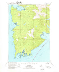
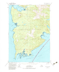
1951 Map of Sitka A-2
USGS Topo · Published 1965About this map
Admiralty Island dominates this 1951 study of the southern tip of the island, where the maritime landscape meets the waters of Chatham Strait and Frederick Sound. The geography is defined by deep coastal indentations like Whitewater Bay and Herring Bay, which provided natural harbors for the area's small maritime outposts. At the southern terminus, the settlement of Tyee sits near Murder Cove and Surprise Harbor, reflecting the early 20th-century dependence on seasonal canning and fishing infrastructure in the Tongass National Forest. Inland, the terrain rises sharply to peaks like Table Mountain and Mt Saffran, showing a wilderness that remained largely unsurveyed beyond the shoreline. Evidence of localized industry appears in labels like the Pumphouse near the southern coast, hinting at the utility systems required for the remote outposts of the era.
Find a feature on this map
37 named features on this map. Tap any name to fly to it.
Don’t see what you’re looking for? This feature index may not catch every label — zoom into the map to look around manually.
Map Details
Editions of this 1951 Sitka A-2 Map
3 editions found
Other maps of this area

1948 · Sitka B-3
USGS Topo · 1:63,360

1948 · Sitka B-1
USGS Topo · 1:63,360

1948 · Sitka A-3
USGS Topo · 1:63,360

1948 · Sitka A-2
USGS Topo · 1:63,360

1948 · Sitka B-2
USGS Topo · 1:63,360

1948 · Port Alexander D-1
USGS Topo · 1:63,360

1948 · Sitka A-1
USGS Topo · 1:63,360

1951 · Sitka
USGS Topo · 1:250,000

1951 · Port Alexander D-3
USGS Topo · 1:63,360

1951 · Port Alexander
USGS Topo · 1:250,000