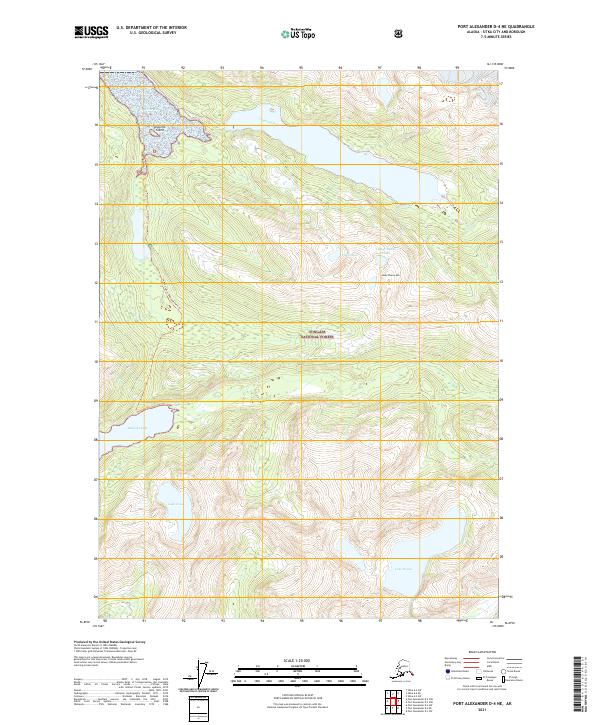
2021 Map of Port Alexander D-4 NE
USGS Topo · Published 2021About this map
Tongass National Forest dominates this coastal Alaska landscape, where deep freshwater basins like Redoubt Lake and Lake Diana are connected by a network of steep drainages. The Salmon Lake-Redoubt Lake Trl provides a primary point of access through the dense wilderness, winding south toward the rugged elevations of Lucky Chance Mtn. Along the northern edge, the Vodopad River feeds into the coastal waters surrounding Arguello Island, illustrating the complex interface of glacial-fed rivers and sea inlets. The distribution of smaller bodies of water, including Pinta Lake, Lake Irina, and the clustered Lucky Chance Lakes, suggests a landscape defined by high-altitude catchments and rapid descent toward the Pacific, characteristic of the Sitka City and Borough region.
Find a feature on this map
17 named features on this map. Tap any name to fly to it.
Don’t see what you’re looking for? This feature index may not catch every label — zoom into the map to look around manually.
Map Details
Editions of this 2021 Port Alexander D-4 NE Map
This is the sole edition of this map. No revisions or reprints were ever made.
Other maps of this area

1948 · Sitka A-3
USGS Topo · 1:63,360

1951 · Sitka
USGS Topo · 1:250,000

1951 · Port Alexander D-4
USGS Topo · 1:63,360

1951 · Port Alexander D-3
USGS Topo · 1:63,360

1951 · Port Alexander
USGS Topo · 1:250,000

1951 · Sitka A-4
USGS Topo · 1:63,360
1951 · Sitka A-3
USGS Topo · 1:63,360

1952 · Port Alexander
USGS Topo · 1:250,000

1952 · Sitka
USGS Topo · 1:250,000

1954 · Sitka A-4
USGS Topo · 1:63,360