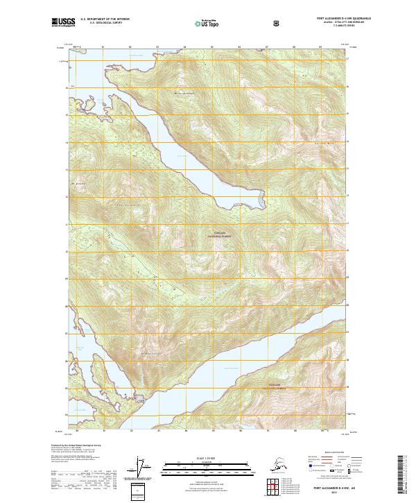
2021 Map of Port Alexander D-4 NW
USGS Topo · Published 2021About this map
Tongass National Forest dominates this coastal landscape on Baranof Island, where the sea meets the steep, glacial topography of the Alexander Archipelago. Deep saltwater incisions like Deep Inlet and Aleutkina Bay provide protected waters, while the interior is defined by sharp peaks such as The Pyramids and Mt Dranishnikof. The presence of Redoubt Lake and the Dranishnikov River indicates a complex hydrological system where freshwater drainages cut through the mountains to reach the Pacific. This terrain, characterized by narrow valleys and high ridges like Eureka Mtn, suggests a region where movement was traditionally dictated by water routes and shoreline topography. The detailed drainage patterns of Kizhuchia Creek and its various spurs offer insight into the natural corridors used by wildlife and early explorers through the dense coastal forest.
Find a feature on this map
25 named features on this map. Tap any name to fly to it.
Don’t see what you’re looking for? This feature index may not catch every label — zoom into the map to look around manually.
Map Details
Editions of this 2021 Port Alexander D-4 NW Map
This is the sole edition of this map. No revisions or reprints were ever made.
Other maps of this area

1948 · Sitka A-5
USGS Topo · 1:63,360

1951 · Port Alexander D-5
USGS Topo · 1:63,360

1951 · Sitka
USGS Topo · 1:250,000

1951 · Port Alexander D-4
USGS Topo · 1:63,360

1951 · Port Alexander
USGS Topo · 1:250,000

1951 · Sitka A-4
USGS Topo · 1:63,360

1951 · Sitka A-5
USGS Topo · 1:63,360

1952 · Port Alexander
USGS Topo · 1:250,000

1952 · Sitka
USGS Topo · 1:250,000

1954 · Sitka A-4
USGS Topo · 1:63,360