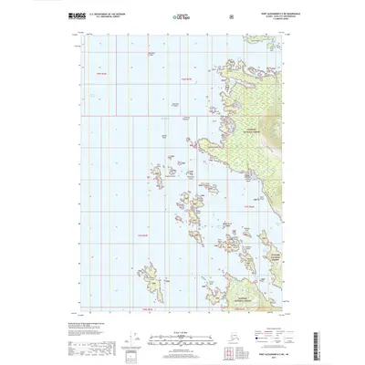
2017 Map of Port Alexander D-5 NE
USGS Topo · Published 2017About this map
Tongass National Forest dominates the eastern coast of this Baranof Island landscape, where the dense wilderness meets the intricate shoreline of the Gulf of Alaska. The coastal geography is defined by a complex archipelago of small landforms, including the Taisud Islands, Koka Island, and Peisar Island. Navigation through these waters is mediated by landforms such as Cape Burunof and Povorotni Point, while interior access is limited to the Kizhuchia Creek Road and its associated spur near Kizhuchia Cr. The map captures a maritime environment where the boundary between sea and land is blurred by numerous inlets like Three Entrance Bay and Kanga Bay, and hazards such as Vasilief Bank and Frosty Reef.
Find a feature on this map
46 named features on this map. Tap any name to fly to it.
Don’t see what you’re looking for? This feature index may not catch every label — zoom into the map to look around manually.
Map Details
Editions of this 2017 Port Alexander D-5 NE Map
This is the sole edition of this map. No revisions or reprints were ever made.
Other maps of this area

1948 · Sitka A-5
USGS Topo · 1:63,360

1951 · Port Alexander D-5
USGS Topo · 1:63,360

1951 · Sitka
USGS Topo · 1:250,000

1951 · Port Alexander D-4
USGS Topo · 1:63,360

1951 · Port Alexander
USGS Topo · 1:250,000

1951 · Sitka A-4
USGS Topo · 1:63,360

1951 · Sitka A-5
USGS Topo · 1:63,360

1952 · Port Alexander
USGS Topo · 1:250,000

1952 · Sitka
USGS Topo · 1:250,000

1954 · Sitka A-4
USGS Topo · 1:63,360