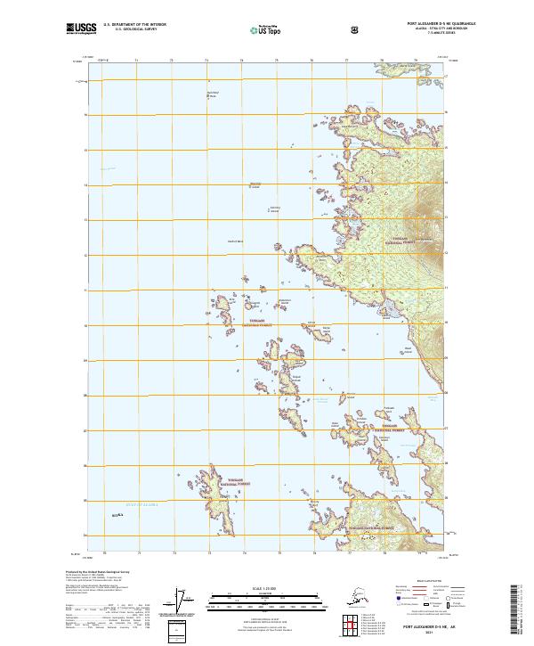
2021 Map of Port Alexander D-5 NE
USGS Topo · Published 2021About this map
The Pyramids rise above the coastal edge of the Tongass National Forest, overlooking a complex marine landscape where the Gulf of Alaska meets the intricate shoreline south of Sitka. The terrain transition is sharp, moving from the steep elevations of Kizuchia Spur down to the sea-level passages and inlets that define this portion of the Alexander Archipelago. The nautical character of the region is evident in the dense cluster of islands including Peisar Island, Kanga Island, and the Taigud Islands, which create sheltered waterways like Koka Island Passage.
Find a feature on this map
47 named features on this map. Tap any name to fly to it.
Don’t see what you’re looking for? This feature index may not catch every label — zoom into the map to look around manually.
Map Details
Editions of this 2021 Port Alexander D-5 NE Map
This is the sole edition of this map. No revisions or reprints were ever made.
Other maps of this area

1948 · Sitka A-5
USGS Topo · 1:63,360

1951 · Port Alexander D-5
USGS Topo · 1:63,360

1951 · Sitka
USGS Topo · 1:250,000

1951 · Port Alexander D-4
USGS Topo · 1:63,360

1951 · Port Alexander
USGS Topo · 1:250,000

1951 · Sitka A-4
USGS Topo · 1:63,360

1951 · Sitka A-5
USGS Topo · 1:63,360

1952 · Port Alexander
USGS Topo · 1:250,000

1952 · Sitka
USGS Topo · 1:250,000

1954 · Sitka A-4
USGS Topo · 1:63,360