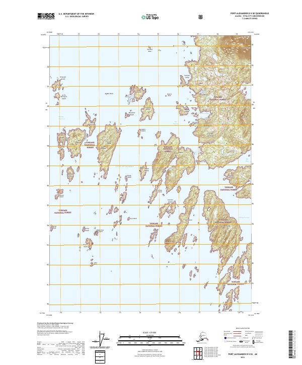
2021 Map of Port Alexander D-5 SE
USGS Topo · Published 2021About this map
Goddard stands as the primary settlement on this coastal survey, situated on the western edge of the Kliuchef Peninsula within the Tongass National Forest. This remote Alaskan landscape is defined by its intricate shoreline where Hot Springs Bay and Kliuchevoi Bay indent the coast near the base of Mt Kliuchef. The map details a complex archipelago of islands, including the Necker Islands and Elovoi Island, separated by deep-water passages such as the Biorka Channel and Windy Passage.
Find a feature on this map
50 named features on this map. Tap any name to fly to it.
Don’t see what you’re looking for? This feature index may not catch every label — zoom into the map to look around manually.
Map Details
Editions of this 2021 Port Alexander D-5 SE Map
This is the sole edition of this map. No revisions or reprints were ever made.
Other maps of this area

1951 · Port Alexander D-5
USGS Topo · 1:63,360

1951 · Port Alexander C-4
USGS Topo · 1:63,360

1951 · Port Alexander D-4
USGS Topo · 1:63,360

1951 · Port Alexander
USGS Topo · 1:250,000

1952 · Port Alexander
USGS Topo · 1:250,000

1964 · Port Alexander
USGS Topo · 1:250,000

1994 · Port Alexander C-4
USGS Topo · 1:63,360
2017 · Port Alexander D-4 NW
USGS Topo · 1:25,000
2017 · Port Alexander D-4 SW
USGS Topo · 1:25,000
2017 · Port Alexander D-5 NE
USGS Topo · 1:25,000