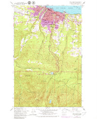
1961 Map of Port Angeles
USGS Topo · Published 1979About this map
Port Angeles dominates this coastal landscape, situated between the deep waters of the Port Angeles Harbor and the soaring peaks of Olympic National Park. The city's mid-century development is visible through its dense grid of residential streets and essential civic infrastructure, including the Courthouse, City Hall, and Olympic Memorial Hospital. Educational facilities such as Queen of Angels Sch and Port Angeles Hi Sch anchor various neighborhoods, while the Chicago Milwaukee St Paul and Pacific rail line skirts the shoreline, emphasizing the city's role as a regional transport hub.
Find a feature on this map
55 named features on this map. Tap any name to fly to it.
Don’t see what you’re looking for? This feature index may not catch every label — zoom into the map to look around manually.
Map Details
Editions of this 1961 Port Angeles Map
3 editions found
Other maps of this area

1918 · Port Angeles
USGS Topo · 1:62,500

1919 · Port Crescent
USGS Topo · 1:62,500

1935 · Mount Olympus
USGS Topo · 1:62,500

1938 · Mt Constance
USGS Topo · 1:125,000

1941 · Port Angeles
USGS Topo · 1:62,500

1942 · Mount Olympus
USGS Topo · 1:62,500

1944 · Mt. Angeles
USGS Topo · 1:62,500

1946 · Mt. Angeles
USGS Topo · 1:62,500

1950 · Elwha
USGS Topo · 1:24,000

1950 · Ediz Hook
USGS Topo · 1:24,000