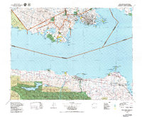
1979 Map of Port Angeles
USGS Topo · Published 1979About this map
Port Angeles and the northern reaches of the Olympic Mountains dominate the southern portion of this international maritime survey, separated by the Juan de Fuca Strait from the southern tip of Vancouver Island. The map documents the urban development of Victoria and its surrounding communities like Langford and Colwood during the late 1970s. This period shows a landscape defined by significant timber and transport infrastructure, where the Esquimalt and Nanaimo Railway and Canadian National Railways trace the rugged coastlines of British Columbia while Highway 101 skirts the northern edge of Olympic National Forest. Local maritime landmarks such as the New Dungeness Lighthouse and Ediz Hook mark the entrance to sheltered harbors, reflecting the era's reliance on both shipping and the growing accessibility of recreation areas near Lake Crescent and Sequim.
Find a feature on this map
75 named features on this map. Tap any name to fly to it.
Don’t see what you’re looking for? This feature index may not catch every label — zoom into the map to look around manually.
Map Details
Editions of this 1979 Port Angeles Map
This is the sole edition of this map. No revisions or reprints were ever made.
Other maps of this area

1918 · Port Angeles
USGS Topo · 1:62,500

1918 · Lake Crescent
USGS Topo · 1:62,500

1919 · Port Crescent
USGS Topo · 1:62,500

1922 · Pysht
USGS Topo · 1:62,500

1922 · Lake Crescent
USGS Topo · 1:62,500

1935 · Mount Olympus
USGS Topo · 1:62,500

1938 · Mt Constance
USGS Topo · 1:125,000

1938 · Dungeness
USGS Topo · 1:62,500

1939 · Port Townsend
USGS Topo · 1:62,500

1939 · Dungeness
USGS Topo · 1:62,500