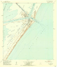
1954 Map of Port Aransas
USGS Topo · Published 1956About this map
The barrier islands of the Texas coast define this 1954 topographic study, centered on the strategic maritime junction of Aransas Pass. The settlement of Port Aransas occupies the northern tip of Mustang Island, where the local economy and infrastructure are clearly geared toward the sea. Evidence of the mid-century industrial footprint is visible at the Tank Farm and Humble Basin on Harbor Island, served by the Corpus Christi Channel and Aransas Channel.
Find a feature on this map
39 named features on this map. Tap any name to fly to it.
Don’t see what you’re looking for? This feature index may not catch every label — zoom into the map to look around manually.
Map Details
Editions of this 1954 Port Aransas Map
This is the sole edition of this map. No revisions or reprints were ever made.
Other maps of this area

1925 · Aransas Pass
USGS Topo · 1:62,500

1950 · Corpus Christi
USGS Topo · 1:250,000

1951 · Crane Islands NW
USGS Topo · 1:24,000

1951 · Allyns Bight
USGS Topo · 1:24,000

1951 · Crane Islands
USGS Topo · 1:62,500

1954 · Aransas Pass
USGS Topo · 1:24,000

1954 · Port Ingleside
USGS Topo · 1:24,000

1954 · Estes
USGS Topo · 1:24,000

1954 · Aransas Pass
USGS Topo · 1:62,500

1956 · Corpus Christi
USGS Topo · 1:250,000