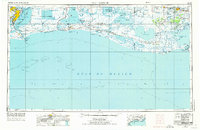
1973 Map of Port Arthur
USGS Topo · Published 1974About this map
Port Arthur and its surrounding coastal industrial corridor define the western edge of this 1970s survey, showing a landscape shaped by the Neches River and the Sabine River. The region’s reliance on maritime trade and petroleum is evident in the sprawling oil and gas fields and the complex of jetties and lights, including the Southwest Pass Lighthouse, that guide traffic through the gulf inlets. Moving eastward, the industrial character yields to the massive wetlands of the Sabine National Wildlife Refuge and Lacassine National Wildlife Refuge, where a network of canals like Stark's Canal and the Intracoastal Waterway thread through the marsh.
Find a feature on this map
146 named features on this map. Tap any name to fly to it.
Don’t see what you’re looking for? This feature index may not catch every label — zoom into the map to look around manually.
Map Details
Editions of this 1973 Port Arthur Map
This is the sole edition of this map. No revisions or reprints were ever made.
Other maps of this area

1926 · Terry
USGS Topo · 1:24,000

1926 · Vidor
USGS Topo · 1:24,000

1932 · Abbeville SW
USGS Topo · 1:31,680

1932 · Sabine Pass NE
USGS Topo · 1:31,680

1932 · Constance Bayou NE
USGS Topo · 1:31,680

1932 · Abbeville SE
USGS Topo · 1:31,680

1932 · Moss Lake
USGS Topo · 1:31,680

1932 · Abbeville NE
USGS Topo · 1:31,680

1932 · Beaumont
USGS Topo · 1:62,500

1932 · Pecan Island SE
USGS Topo · 1:31,680