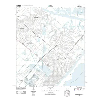
2010 Map of Port Arthur North
USGS Topo · Published 2010About this map
The industrial and residential corridors of the Texas Gulf Coast are deeply integrated in this map of the Golden Triangle area. Port Arthur serves as a major hub, bounded by the Sabine Neches Canal and the waters surrounding Pleasure Island. The landscape is a complex network of waterways like the Neches River and the Atlantic Canal, which separate the established neighborhoods of Nederland, Port Neches, and Groves. This survey captures the urban fabric of late 20th-century development, including the campus of Lamar University and smaller communities such as Pear Ridge and Griffing Park. Significant local history and genealogy markers are present, ranging from the Johnson Cemetery and Calvary Cemetery to the Veterans Memorial Monument near the coastal marshes. The arrangement of recreational spaces like the Babe Didrikson Zaharias Memorial Golf Course reflects the civic investment in this petrochemical-dominated landscape.
Find a feature on this map
54 named features on this map. Tap any name to fly to it.
Don’t see what you’re looking for? This feature index may not catch every label — zoom into the map to look around manually.
Map Details
Editions of this 2010 Port Arthur North Map
This is the sole edition of this map. No revisions or reprints were ever made.
Other maps of this area

1926 · Terry
USGS Topo · 1:24,000

1926 · Vidor
USGS Topo · 1:24,000

1932 · Beaumont
USGS Topo · 1:62,500

1932 · Port Arthur NE
USGS Topo · 1:31,680

1943 · West of Johnson Bayou
USGS Topo · 1:24,000

1943 · West of Greens Bayou
USGS Topo · 1:24,000

1943 · Orangefield
USGS Topo · 1:24,000

1943 · Port Arthur North
USGS Topo · 1:24,000

1943 · Terry
USGS Topo · 1:24,000

1943 · Port Arthur South
USGS Topo · 1:24,000