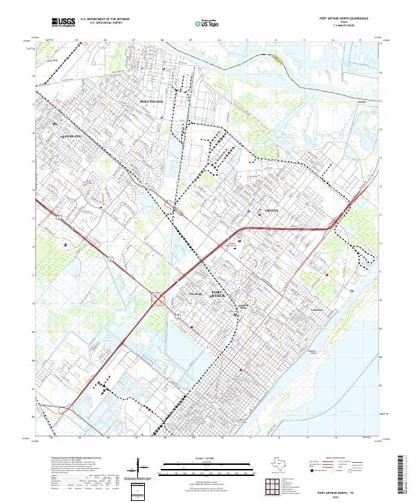
2022 Map of Port Arthur North
USGS Topo · Published 2022About this map
Industrial waterways and dense residential grids define this coastal corridor between Port Neches and the northern reaches of Port Arthur. The landscape is a complex network of transit and trade, anchored by the Neches River and the Sabine Neches Canal, which bypasses Sabine Lake to the west. This 2022 survey captures the modern footprint of communities like Nederland and Groves, showing the close proximity of educational institutions like Lamar State College Port Arthur to the region's massive petrochemical infrastructure. Notable landmarks include the sprawling Greenlawn Memorial Park and Calvary Cem, providing essential points of reference for local historians. From the marshes of Bird Island Bayou to the developed shores of Pleasure Island, the map illustrates how the Intracoastal Waterway and the Atlantic Canal have fundamentally reshaped the Jefferson County coastline for maritime commerce.
Find a feature on this map
338 named features on this map. Tap any name to fly to it.
Don’t see what you’re looking for? This feature index may not catch every label — zoom into the map to look around manually.
Map Details
Editions of this 2022 Port Arthur North Map
This is the sole edition of this map. No revisions or reprints were ever made.
Other maps of this area

1926 · Terry
USGS Topo · 1:24,000

1926 · Vidor
USGS Topo · 1:24,000

1932 · Beaumont
USGS Topo · 1:62,500

1932 · Port Arthur NE
USGS Topo · 1:31,680

1943 · West of Johnson Bayou
USGS Topo · 1:24,000

1943 · West of Greens Bayou
USGS Topo · 1:24,000

1943 · Orangefield
USGS Topo · 1:24,000

1943 · Port Arthur North
USGS Topo · 1:24,000

1943 · Terry
USGS Topo · 1:24,000

1943 · Port Arthur South
USGS Topo · 1:24,000