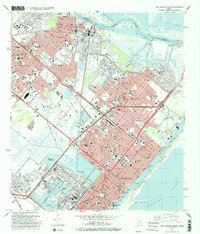
1993 Map of Port Arthur North
USGS Topo · Published 1993About this map
The industrial corridor of Southeast Texas is defined here by the closely knit communities of Port Neches, Nederland, Groves, and Port Arthur. This late twentieth-century landscape reveals a dense network of residential streets and civic institutions, including numerous schools like the Port Neches-Groves High Sch and Thomas Jefferson High Sch. The region's connection to the water is central, with the Neches River flowing toward Sabine Lake and the Port Arthur Road acting as a primary artery.
Find a feature on this map
68 named features on this map. Tap any name to fly to it.
Don’t see what you’re looking for? This feature index may not catch every label — zoom into the map to look around manually.
Map Details
Editions of this 1993 Port Arthur North Map
This is the sole edition of this map. No revisions or reprints were ever made.
Other maps of this area

1926 · Terry
USGS Topo · 1:24,000

1926 · Vidor
USGS Topo · 1:24,000

1932 · Beaumont
USGS Topo · 1:62,500

1932 · Port Arthur NE
USGS Topo · 1:31,680

1943 · West of Johnson Bayou
USGS Topo · 1:24,000

1943 · West of Greens Bayou
USGS Topo · 1:24,000

1943 · Orangefield
USGS Topo · 1:24,000

1943 · Port Arthur North
USGS Topo · 1:24,000

1943 · Terry
USGS Topo · 1:24,000

1943 · Port Arthur South
USGS Topo · 1:24,000