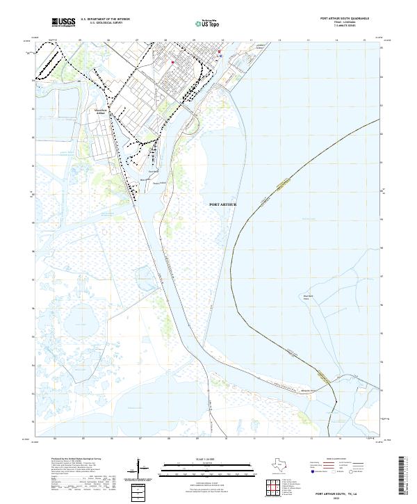
2022 Map of Port Arthur South
USGS Topo · Published 2022About this map
The industrial shoreline of Port Arthur and West Port Arthur meets the marshy expanse of the Texas-Louisiana border in this contemporary study. The landscape is defined by its massive water-control and shipping infrastructure, including the Intracoastal Waterway and the Sabine Neches Canal, which carve through the coastal wetlands. Named features like Texaco Island, West Basin, and East Basin highlight the area's role as a major maritime and petrochemical hub. Beyond the dredged channels, the natural geography persists in the sprawling waters of Sabine Lake and the intricate network of Taylor Bayou, Salt Bayou, and Johnson Lake. The map details the transition from the grid-patterned streets of the city, such as W Thomas Blvd and Texas Ave, to the unpopulated marshes of Cameron Parish across Sabine Pass. This survey illustrates the delicate balance between high-intensity navigation and the expansive coastal prairie.
Find a feature on this map
86 named features on this map. Tap any name to fly to it.
Don’t see what you’re looking for? This feature index may not catch every label — zoom into the map to look around manually.
Map Details
Editions of this 2022 Port Arthur South Map
This is the sole edition of this map. No revisions or reprints were ever made.
Other maps of this area

1932 · Sabine Pass NE
USGS Topo · 1:31,680

1932 · Port Arthur NE
USGS Topo · 1:31,680

1943 · West of Johnson Bayou
USGS Topo · 1:24,000

1943 · West of Greens Bayou
USGS Topo · 1:24,000

1943 · Port Arthur North
USGS Topo · 1:24,000

1943 · Port Arthur South
USGS Topo · 1:24,000

1944 · Sabine Pass
USGS Topo · 1:31,680

1944 · Texas Point
USGS Topo · 1:31,680
1946 · Port Arthur NE
USGS Topo · 1:31,680
1946 · Sabine Pass NE
USGS Topo · 1:31,680