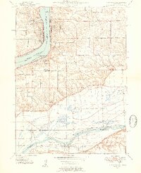
1949 Map of Port Byron
USGS Topo · Published 1954About this map
The Mississippi River and Rock River define this 1940s landscape at the border of Illinois and Iowa, where early mid-century infrastructure meets long-standing rural settlements. This survey captures a dense network of one-room schoolhouses such as Shake-Rag Sch, Leafy Bower Sch, and Rose Hill Sch before the era of widespread school consolidation. The presence of the Old Indian Boundary Line running through the southern portion of the quadrangle highlights the enduring imprint of historical treaties on the physical geography of the region.
Find a feature on this map
40 named features on this map. Tap any name to fly to it.
Don’t see what you’re looking for? This feature index may not catch every label — zoom into the map to look around manually.
Map Details
Editions of this 1949 Port Byron Map
2 editions found
Other maps of this area

1892 · Leclaire
USGS Topo · 1:62,500

1893 · Leclaire
USGS Topo · 1:62,500

1899 · Clinton
USGS Topo · 1:125,000

1934 · Geneseo
USGS Topo · 1:62,500

1937 · Orion
USGS Topo · 1:62,500

1949 · Coal Valley
USGS Topo · 1:24,000

1949 · Silvis
USGS Topo · 1:24,000

1949 · Port Byron
USGS Topo · 1:24,000

1950 · Port Byron
USGS Topo · 1:24,000

1952 · Erie
USGS Topo · 1:62,500