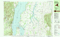
1980 Map of Port Henry
USGS Topo · Published 1981About this map
Lake Champlain serves as the dominant axis of this 1980 survey, marking the border between New York and Vermont. On the western shore, Port Henry anchors the landscape beneath the rising peaks of the Adirondack Park, including Bald Peak and Cheney Mtn. This area reflects a deep historical layer, preserved at the narrows where Chimney Point and Crown Point nearly meet. Here, the Fort St Frederic Ruins and Port Crown Point Ruins stand as physical markers of colonial-era military strategy, overseen by a Lighthouse and connected by the Lake Champlain Bridge. To the east in Vermont, the terrain shifts from the high ridges of Snake Mountain to the sprawling wetlands of the Dead Creek WMA. The presence of the Delaware and Hudson railroad and numerous family-named burial sites like Walton Cem and Spear Cem provides a detailed look at the region's infrastructure and genealogy.
Find a feature on this map
57 named features on this map. Tap any name to fly to it.
Don’t see what you’re looking for? This feature index may not catch every label — zoom into the map to look around manually.
Map Details
Editions of this 1980 Port Henry Map
This is the sole edition of this map. No revisions or reprints were ever made.
Other maps of this area

1894 · Elizabethtown
USGS Topo · 1:62,500

1894 · Port Henry
USGS Topo · 1:62,500

1894 · Ticonderoga
USGS Topo · 1:62,500

1895 · Elizabethtown
USGS Topo · 1:62,500

1895 · Paradox Lake
USGS Topo · 1:62,500

1896 · Ticonderoga
USGS Topo · 1:62,500

1897 · Paradox Lake
USGS Topo · 1:62,500

1898 · Port Henry
USGS Topo · 1:62,500

1901 · Elizabethtown
USGS Topo · 1:62,500

1902 · Ticonderoga
USGS Topo · 1:62,500