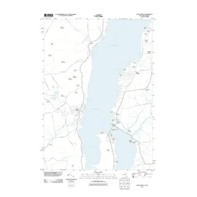
2012 Map of Port Henry
USGS Topo · Published 2012About this map
Lake Champlain serves as the central artery for this region of the Adirondacks, separating the New York shoreline from Vermont. On the western bank, the village of Port Henry sits beneath a series of named peaks including Burns Mountain, Cheney Mountain, and Quinn Mountain. The landscape is dotted with family and church-related burial grounds such as Saint Patrick Cemetery, Walton Cemetery, and the Union Cemetery, reflecting the long-established settlement patterns of Essex County.
Find a feature on this map
82 named features on this map. Tap any name to fly to it.
Don’t see what you’re looking for? This feature index may not catch every label — zoom into the map to look around manually.
Map Details
Editions of this 2012 Port Henry Map
This is the sole edition of this map. No revisions or reprints were ever made.
Other maps of this area

1894 · Elizabethtown
USGS Topo · 1:62,500

1894 · Port Henry
USGS Topo · 1:62,500

1894 · Ticonderoga
USGS Topo · 1:62,500

1895 · Elizabethtown
USGS Topo · 1:62,500

1895 · Paradox Lake
USGS Topo · 1:62,500

1896 · Ticonderoga
USGS Topo · 1:62,500

1897 · Paradox Lake
USGS Topo · 1:62,500

1898 · Port Henry
USGS Topo · 1:62,500

1901 · Elizabethtown
USGS Topo · 1:62,500

1902 · Ticonderoga
USGS Topo · 1:62,500