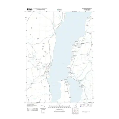
2013 Map of Port Henry
USGS Topo · Published 2013About this map
Port Henry sits on the western shore of Lake Champlain, serving as a primary focal point for this survey of the New York-Vermont borderlands. The village’s waterfront is marked by the Town Pier of Port Henry and the Van Slooten Harbour Marina, reflecting the long-standing maritime character of the region. Across the water, the landscape shifts to the Vermont side with settlements like West Addison and landmarks such as Chimney Point and Crown Point. The narrow connection between the two states is dominated by the Lake Champlain Toll Bridge and the nearby Crown Point Light. In the interior of Essex County, the terrain rises sharply into named peaks like Cheney Mtn and Bald Peak, while family and community history is preserved in sites like the Walton Cem, Stevenson Cem, and the Black Watch Farm.
Find a feature on this map
114 named features on this map. Tap any name to fly to it.
Don’t see what you’re looking for? This feature index may not catch every label — zoom into the map to look around manually.
Map Details
Editions of this 2013 Port Henry Map
This is the sole edition of this map. No revisions or reprints were ever made.
Other maps of this area

1894 · Elizabethtown
USGS Topo · 1:62,500

1894 · Port Henry
USGS Topo · 1:62,500

1894 · Ticonderoga
USGS Topo · 1:62,500

1895 · Elizabethtown
USGS Topo · 1:62,500

1895 · Paradox Lake
USGS Topo · 1:62,500

1896 · Ticonderoga
USGS Topo · 1:62,500

1897 · Paradox Lake
USGS Topo · 1:62,500

1898 · Port Henry
USGS Topo · 1:62,500

1901 · Elizabethtown
USGS Topo · 1:62,500

1902 · Ticonderoga
USGS Topo · 1:62,500