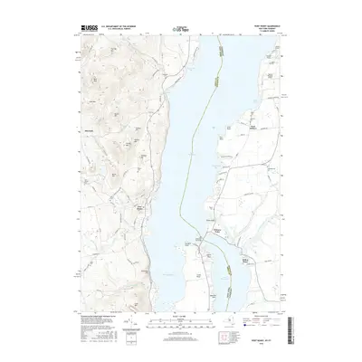
2016 Map of Port Henry
USGS Topo · Published 2016About this map
Port Henry and Mineville anchor the western shore of Lake Champlain on this survey, where the Adirondack landscape meets the water. The map traces the historic connections between these New York settlements and the Vermont shore, most notably via the Lake Champlain Toll Bridge at Chimney Point. This crossing point is a central geographical feature, linking the industrial and mining legacy of the New York hills to the more agricultural landscape around West Addison. The terrain is defined by prominent peaks like Bald Peak and Cheney Mtn, which drop toward the shoreline at Bulwagga Bay and Craig Harbor. Numerous small burial grounds, including Saint Patrick Cem and the Union Cem, are documented throughout the hills, providing valuable data for genealogists tracking local families in this border region. The presence of both Yankee Kingdom Airport and Staton Airport highlights the transport infrastructure serving the lake's eastern and western banks.
Find a feature on this map
104 named features on this map. Tap any name to fly to it.
Don’t see what you’re looking for? This feature index may not catch every label — zoom into the map to look around manually.
Map Details
Editions of this 2016 Port Henry Map
This is the sole edition of this map. No revisions or reprints were ever made.
Other maps of this area

1894 · Elizabethtown
USGS Topo · 1:62,500

1894 · Port Henry
USGS Topo · 1:62,500

1894 · Ticonderoga
USGS Topo · 1:62,500

1895 · Elizabethtown
USGS Topo · 1:62,500

1895 · Paradox Lake
USGS Topo · 1:62,500

1896 · Ticonderoga
USGS Topo · 1:62,500

1897 · Paradox Lake
USGS Topo · 1:62,500

1898 · Port Henry
USGS Topo · 1:62,500

1901 · Elizabethtown
USGS Topo · 1:62,500

1902 · Ticonderoga
USGS Topo · 1:62,500