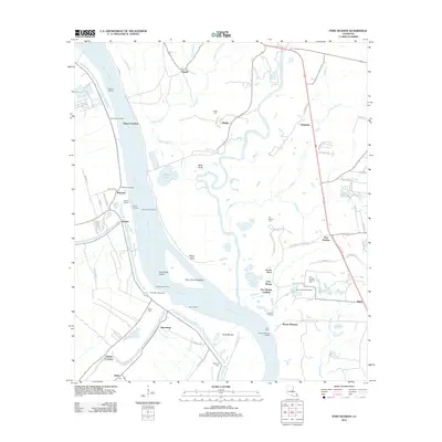
2012 Map of Port Hudson
USGS Topo · Published 2012About this map
Port Hudson National Cem stands as a prominent historical landmark on the bluffs overlooking the Mississippi River, anchoring a region defined by its complex river geography and scattered riverfront settlements. This 2012 survey captures the shifting nature of the waterway, evidenced by the False River Cutoff and several engineered features like the Grand Bay Revetment and False Berm. The landscape is a network of small communities and landings, including Mount Pleasant, Waterloo, and Port Hickey, many connected by rural routes such as W Plains Port Hudson Rd.
Find a feature on this map
85 named features on this map. Tap any name to fly to it.
Don’t see what you’re looking for? This feature index may not catch every label — zoom into the map to look around manually.
Map Details
Editions of this 2012 Port Hudson Map
This is the sole edition of this map. No revisions or reprints were ever made.
Other maps of this area

1906 · Bayou Sara
USGS Topo · 1:125,000

1939 · St. Francisville
USGS Topo · 1:62,500

1939 · Zachary
USGS Topo · 1:62,500

1945 · Jackson
USGS Topo · 1:31,680

1953 · New Roads
USGS Topo · 1:24,000

1954 · Zachary
USGS Topo · 1:24,000

1954 · Port Hudson
USGS Topo · 1:24,000

1954 · Walls
USGS Topo · 1:24,000

1954 · Elm Park
USGS Topo · 1:24,000
1954 · Scotlandville
USGS Topo · 1:24,000