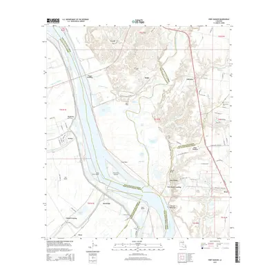
2015 Map of Port Hudson
USGS Topo · Published 2015About this map
Mississippi River bluffs and oxbow remnants dominate this landscape where four Louisiana parishes converge. The eastern banks are defined by high ground like Painted Bluffs and Balls Bluff, which historically provided strategic vantage points over the river's shifting course. These elevations contrast with the low-lying western terrain of The Island and the complex drainage of Grants Bayou and Alligator Bayou. Evidence of the region's river-dependent economy is visible through multiple landings and points of transition, including Port Hickey Landing, Dugan Landing, and Chenal Crossing. Interior settlements like Port Hudson and Riddle are marked by long-standing community landmarks such as Port Hudson Cem and Riddle Cem, while the hydrological history of the area is preserved in features like the False River Cutoff and Grand Lake.
Find a feature on this map
104 named features on this map. Tap any name to fly to it.
Don’t see what you’re looking for? This feature index may not catch every label — zoom into the map to look around manually.
Map Details
Editions of this 2015 Port Hudson Map
This is the sole edition of this map. No revisions or reprints were ever made.
Other maps of this area

1906 · Bayou Sara
USGS Topo · 1:125,000

1939 · St. Francisville
USGS Topo · 1:62,500

1939 · Zachary
USGS Topo · 1:62,500

1945 · Jackson
USGS Topo · 1:31,680

1953 · New Roads
USGS Topo · 1:24,000

1954 · Zachary
USGS Topo · 1:24,000

1954 · Port Hudson
USGS Topo · 1:24,000

1954 · Walls
USGS Topo · 1:24,000

1954 · Elm Park
USGS Topo · 1:24,000
1954 · Scotlandville
USGS Topo · 1:24,000