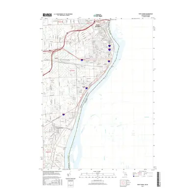
2017 Map of Port Huron
USGS Topo · Published 2017About this map
The St. Clair River forms a massive international boundary here, separating the industrial and residential corridors of Port Huron and Marysville from the Canadian shoreline. This 2017 survey shows a landscape defined by its waterways and transit history, from the prominent Blue Water Bridge in the north to the industrial fingerprints of the Grand Trunk Western Driveway. Local history and genealogy interests are well-served by the inclusion of Woodlawn Cem and Riverlawn Cem, as well as established educational institutions like Baker Coll of Port Huron. Small settlements and neighborhoods like Tappan and South Park are clearly delineated alongside a complex drainage network that includes Black River, Stocks Cr, and Bunce Cr. The map captures the modern layout of this critical border crossing, where the river remains the central geographic and economic feature.
Find a feature on this map
192 named features on this map. Tap any name to fly to it.
Don’t see what you’re looking for? This feature index may not catch every label — zoom into the map to look around manually.
Map Details
Editions of this 2017 Port Huron Map
This is the sole edition of this map. No revisions or reprints were ever made.
Other maps of this area

1912 · Port Huron
USGS Topo · 1:62,500

1928 · Hicky
USGS Topo · 1:62,500

1929 · Port Huron
USGS Topo · 1:62,500

1936 · St. Clair
USGS Topo · 1:31,680

1936 · Rattle Run
USGS Topo · 1:31,680

1939 · Port Huron
USGS Topo · 1:24,000

1939 · St. Clair
USGS Topo · 1:24,000

1939 · Smiths Creek
USGS Topo · 1:24,000

1942 · Rattle Run
USGS Topo · 1:24,000
1949 · Port Huron
USGS Topo · 1:24,000