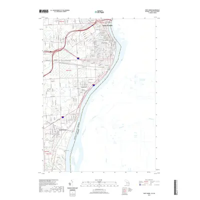
2019 Map of Port Huron
USGS Topo · Published 2019About this map
Port Huron and Marysville anchor this 2019 survey of the international border along the St. Clair River. The landscape is defined by the vital transit links connecting Michigan to Ontario, most notably the Blue Water Bridge and the subterranean Saint Clair Tunnel. The urban core of Port Huron is densely mapped, featuring the Saint Clair County Building and the campus of Saint Clair County Community College. Industrial and maritime heritage is evident in the rail lines of the Grand Funk Western and the complex drainage network including Stocks Creek and Bunce Cr. Genealogists will find the locations of Woodlawn Cem and Riverlawn Cem useful for tracing local family history in the outlying residential districts of Tappan and South Park.
Find a feature on this map
173 named features on this map. Tap any name to fly to it.
Don’t see what you’re looking for? This feature index may not catch every label — zoom into the map to look around manually.
Map Details
Editions of this 2019 Port Huron Map
This is the sole edition of this map. No revisions or reprints were ever made.
Other maps of this area

1912 · Port Huron
USGS Topo · 1:62,500

1928 · Hicky
USGS Topo · 1:62,500

1929 · Port Huron
USGS Topo · 1:62,500

1936 · St. Clair
USGS Topo · 1:31,680

1936 · Rattle Run
USGS Topo · 1:31,680

1939 · Port Huron
USGS Topo · 1:24,000

1939 · St. Clair
USGS Topo · 1:24,000

1939 · Smiths Creek
USGS Topo · 1:24,000

1942 · Rattle Run
USGS Topo · 1:24,000
1949 · Port Huron
USGS Topo · 1:24,000